[9/28/2018] The below info has a status change. As of Friday September 28, 2018 the Narrows, Top Down permits are again being issued. An agreement was reached with a landowner, to resolve the conflict.
___________________________
[9/25/2018] Reports started flowing in 9/25/2018 that Zion National Park has suspended issuing permits to the “Narrows” area, including the popular “Top-Down” trips.
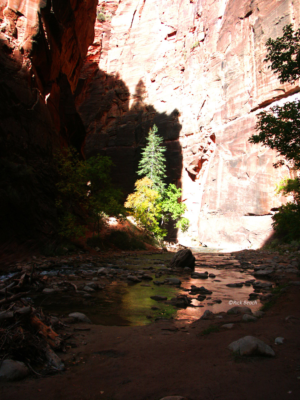
Zion Narrows
This is due to a dispute over Private Property rights.
Day hiking from the Temple of Sinawava to Big Spring is open. Upstream travel beyond Big Spring is prohibited.
We haven’t heard what has triggered this. It is a reminder to respect the land, and the locals at all times, no matter where you travel. You never know what might make someone decide to no longer share.
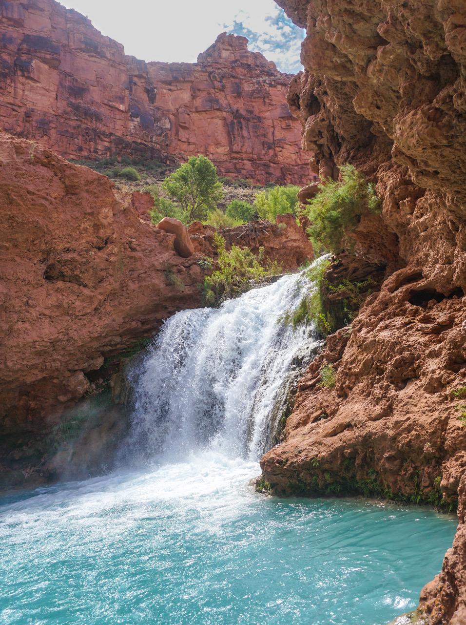
One of our contributors has provided a great write-up on Hidden Falls. Again we wish to thank Jessica Rose for her time. But alas we have been informed this area is Off Limits to visitors/tourists.
Those recommending a visit to this area are misinformed. We where given information that this particular Falls, and general side trail area is not marked on purpose . Visitors and tourists are not suppose to be in this area.
Brain Volk writes:
There is a reason that there aren’t signs marking this falls, and above it, on the trail, there are signs saying not to go there. The cliff and ground around it is unstable.
The Ramada (wooden structure) is rebuilt and used for ceremonies. Its not an area where tourists are supposed to go. We are not welcome to go off the main trail here.
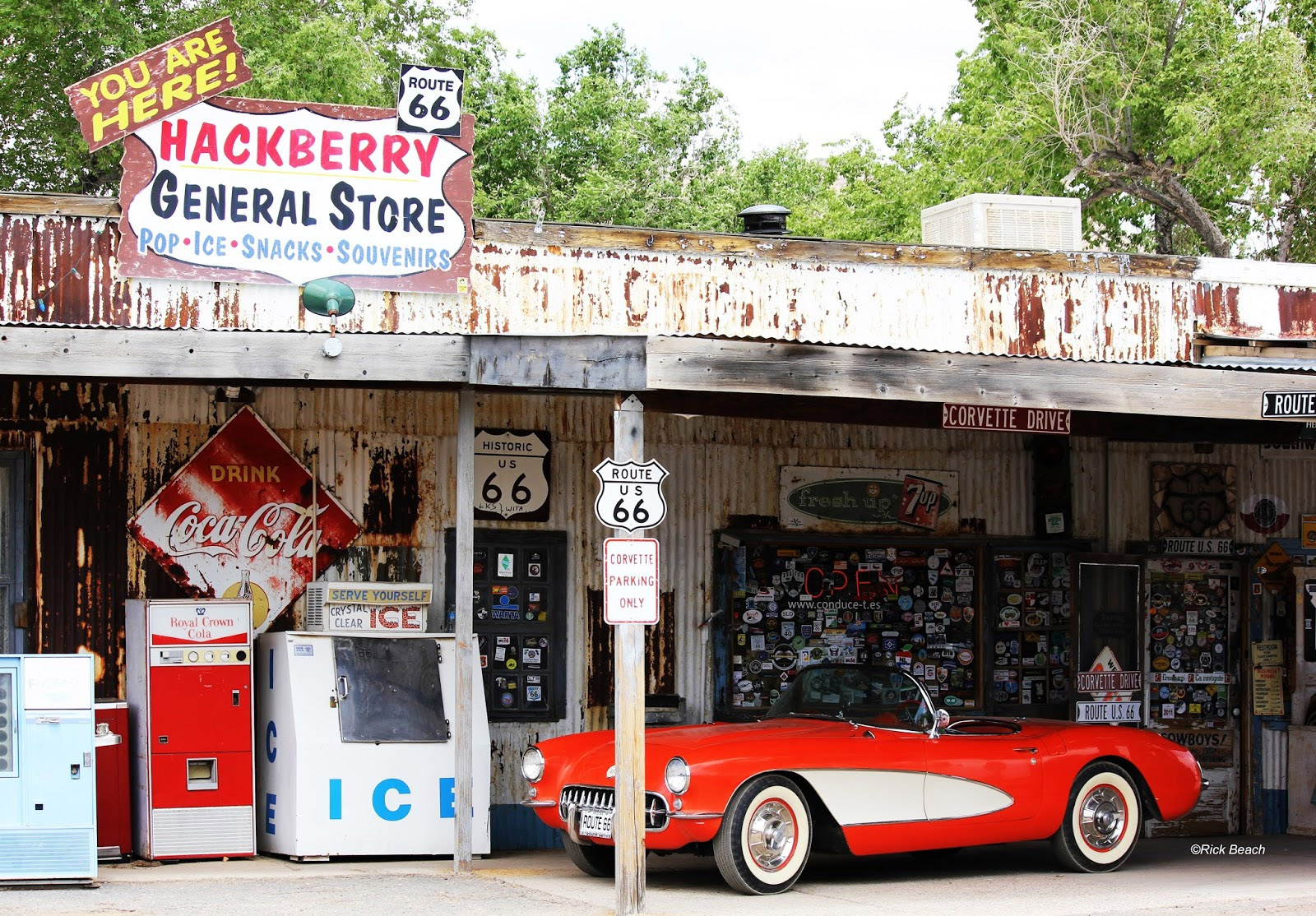
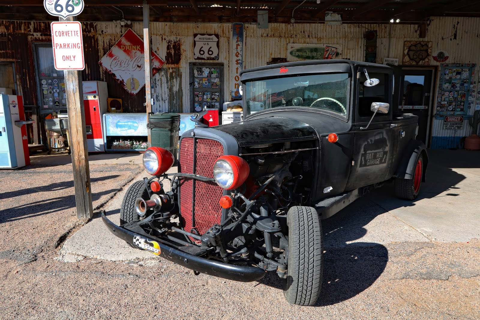
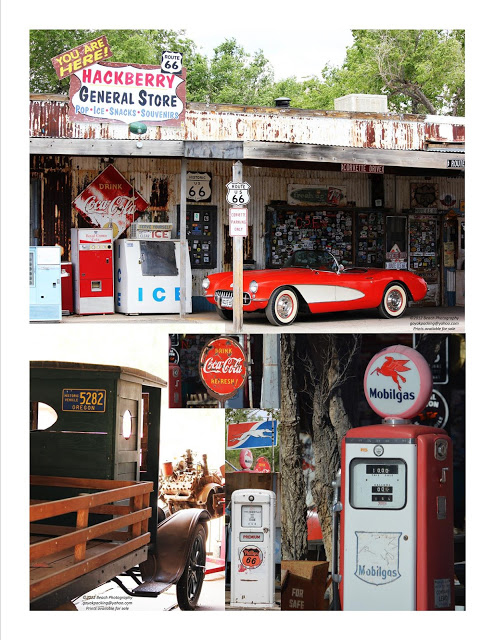
Today I stumbled into information related to the Hackberry General Store along Old Route 66, and an artist named Willem Bor. The route is often referred to as the “Mother Road”. The artist, fascinated by the route and old structures, set off to recreate them in model form.
If you are making a road trip from the west to Backpack Havasu Falls you will mostly likely pass right by the Hackberry General Store. Be sure to factor in some time to make a stop.
The artist info linked further in this article becomes so much more if you stop, get out, and explore the Hackberry General Store area.
Have you ever gotten to a page on the internet you have no idea how it happened? Suddenly into some obscure website that piques your interest? Subject related to something you would have never thought to go searching for it? Ah, the pleasures of modern technology. It allows you to travel the world in micro-seconds.
I have driven old sections of Route 66 over the years. I know I have been on numerous parts of it across the U.S. Chopped up pieces. Parts now off the beaten path of the much faster Interstate Highways. Though at this stage most of my recollection is isolated to some Arizona sections. Many small towns are locked in time. Seeming to stand unchanged since the time the Interstates bypassed once vibrant travel stops.
On the the subject I really wish to share. I stumbled into a blog of an artist (Willem Bor). His blog was created to show his craft of model making. Oddly he did not live in USA. But fell in love with the buildings along Old Route 66 during a visit. Many which are disappearing with time and decay. Willem Bor set off to recreate them in miniature form. In detail you may find hard to believe.
One building in particular is currently still standing and called “Hackberry’s General Store”. I have actually been there on numerous occasions, and have done my own photography.
Check out his blog link below. You can find the Hackberry General Store built in model size. Compare it to our photos on this page. Visit it in person should you have the opportunity. Then you judge how cool these model buildings are. I also love the history that is provided with each piece.
Sadly, in researching and going to his Facebook page I believe he is no longer with us since January 2017? His work and website lives on, at least for now. We can only hope he is traveling along Route 66 and comparing his work.
Hackberry’s General Store is a “must do” road trip stop. If you are traveling on Old Route 66 between Kingman, Arizona, and Peach Springs, Arizona. This is a great spot to stop. No gas available that I know of, but a fun place. Photo ops in every direction.
Hackberry’s General Store is a trip destination in itself. If you have the time, travel old Route 66 heading northeast out of Kingman, Arizona driving toward Peach Springs. Time it so you are in the area during the day. Hackberry is roughly midpoint between Kingman and Peach Springs.
This building has featured photos appearing in numerous advertisements. It’s iconic image is known worldwide. It is a favorite stop for many enjoying a trip on old Route 66.
Also a popular stop on any trip people are making to Havasu Falls for backpacking trips. Especially if traveling in from the west. Just allow yourself some extra time for this stop. You might think a few minutes is all that is necessary. No so.
If you enjoying shooting photos your better factor in at least an hour. Tons of old cars and car parts are scattered across the property. Old gas pumps, old metal signs, and broken down machinery.
Stop in and browse the interior too. The place has an old time staged soda fountain. The bathroom decor is a hoot. There are dollar bills plastered on the ceiling and walls by travelers from all over the world.
Bring your camera because the building and all of the “old iron” scattered around is a photographers dream.
Address: 11255 E Hwy 66 Hackberry, AZ 86401
Mooney Falls Trail Article and Still image by: Rick Beach.
Video by: Nataliia Sheianova.
Mooney Falls is about 200 ft high. The trail from the top to the bottom is not for some with a fear of heights.
The last half of the climb down is normally bathed in mist off the falls. For some this part is very scary. You are grasping chains to secure yourself. Rock footing is wet and slick. You are on a near vertical cliff face. Descending first. But the only way back out, is to take the same route back up.
There is often 2 way traffic. Some people have no courtesy to wait. This is even more intimidating to those that are timid and not real sure they should be attempting this climb. Maintain 3 point contact at all times! For many it is the highlight of the trip.
Once down at the base of Mooney Falls it opens you to a vast area of more water falls. Beaver Falls several more hours of hiking downstream is a “must do” also.
Mooney Falls Trail Video: Courtesy of Nataliia Sheianova
Our initial trip was organized under our former trademark business. This all started back in 2010.
At at the time TOPONAUTIC was a business under another name and trademark. This was written up in one of our old newsletters. We have gone through and changed the name to our current business name of Toponautic.
Yes, the TOPONAUTIC Staff and Friends made the trip. We basically shut down operations for 4 days so we could all join in. This was our first trip to Havasu Falls. It was to be a short trip since we only secured reservations for one night of camping. It was to be more of a recon mission.
This trip is not for the poorly prepared, nor poorly conditioned. Not if you are backpacking it both in and out. We found the backpack trip fun, difficult at times, but so rewarding for the experience, the beauty, and peace found in the area.
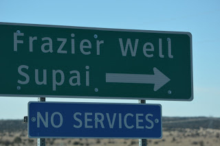
We left out of Las Vegas, driving some 4 hours or so, headed for the trail head. We passed through Kingman, Arizona and headed generally Northeast on an old section of Route 66. Along the way, just beyond Peach Springs, Arizona we made a turn north on Indian Road #18.
IR#18 is a desolate 2 lane road with absolutely no services. From there we traveled another 60 some miles to a dead-end at the Trail Head.
Our group was made up of an age group from 35 to 61. All of us had prepared in advance by doing conditioning hikes with backpacks. Nothing can prepare you for the real thing we found out.
All of us read as much info as we could find, and spoke to people that have made multiple trips to Havasu Falls. We had all chosen our equipment, packs, and the weight we were going with. The lightest was a pack weight (minus water) of 20 lbs. The heaviest in the group was 40 lbs (minus water). So, add 7.5 lbs. of water to find our actual pack weights. Mine was 30 + 7.5 or 37.5 lbs. I found out the hard way this was way too heavy to enjoy the trip!
We had our meals figured so we were not packing extra.
We arrived late afternoon with an original plan to camp near our vehicle at the trail head. Probably what many people think might be do-able. Upon arriving we re-thought that plan. This proved to be a large error on our part. But that is why we considered this a recon mission. We had people tell us they set up tents here. Wow, that was misleading. At least to us.
The parking area is basically a shelf cut into the canyon wall. Nearly a straight drop off on the west side. The remaining side is nearly straight up with barely room to park. There was rock fall evidence in the remaining 5 or 6 feet between vehicles and the rock wall. I even feared damage to the vehicle from falling rocks. Pitching a tent or just plain sleeping on the ground in that space was out of the question.
The area is dark and trying to lay out something between vehicles might be hazardous with late arrivals coming in. Plus the parking lot was full, with cars lining the road leading back up the hill.
At the trail head we found horse corrals, composting toilets, a few dogs and a couple locals there to coordinate pack animals. We asked if it was OK to head out and camp along the trail. We were told yes as long as we got away from the trail to camp. (I think if you check now, this is no longer allowed?)
Our objective was to get down the descending switchbacks before dark. We grabbed our packs and hit the trail. The weather was very pleasant and we made the 2 miles of switchbacks in short order (about 45 minutes). We dropped into the wash trail and headed downhill, north, toward the village of Supai.
We estimated we had made about 3 miles in close to an hour, since leaving the trail head. We found a large flat ledge several hundred feet above the trail. We scrambled up some rocks and set up camp. Tents were up and dinner cooked and eaten. It was time to relax and talk about how those switchbacks might be, going up the day of our departure. We knew is wouldn’t be nearly as easy! Little did we know at that time how true this was.
We had planned our trip on the full moon, so as darkness set in, the canyon wall off to our east gradually started showing signs of the moon coming up. Suddenly it peaked above the dark horizon. Then with surprising speed rose higher and cleared the horizon. It lit us up as if we were camped near a street light. We tried for the longest time to capture the moment with our cameras. But nothing can capture what we saw and felt. Those will just be fond memories to us.
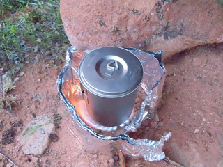
Morning came with cool air and a light breeze. We boiled some water, mixed up some oatmeal and sipped on a hot cup of coffee. Food Prep cleaned up, tents and bags rolled up, and we were off heading the remaining miles to the Village. The total distance from the upper trail head to the village is about 9 miles. We had already spent 1 hour hiking the day before, and estimated we had 3 miles behind us. The view from where we had breakfast that morning was totally awesome. It was high enough to see the larger canyon that lay before us, and also the narrower trail canyon down below us in the wash.
The trail had a fairly steady drop, but not that steep, generally meandering along a deep wash that had been cut through steep sandstone walls over eons of time. We were walking somewhat labored since the trail was loose gravel and deep loose sand. At times the trail went to a little higher ground and through some desert vegetation. This went on for several miles. Occasionally we came to a more narrow passage and large slabs of sandstone that had broken loose and fallen from the walls above
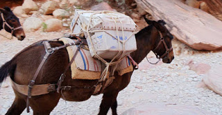
We were traveling fairly fast, averaging over 3 mph per our GPS. Suddenly we heard a strange noise. We thought a waterfall at first. About that time several horses came running around the corner, headed up hill, with a rider close behind. The horses were pack animals. Some of the tied down material was the US mail making its way out of the village. This wash is the only way in and out of the village other than by helicopter. No roads exist. Off and on we would meet more oncoming pack animals.
We read, and were also told that this is the only US Post Office that still delivers US Mail via horse back or mule. We made a point of wanting to send a post card home from the village once we arrived.
We moved fast in the cool of the early morning, though the sun was rising we remained pretty much in the shadows of the steep canyon walls. We paused briefly among some huge slabs of rock, ate a snack, and watched another string of pack animals trot by in a cloud of dust.
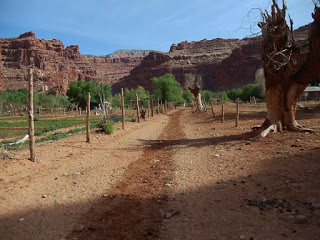
South entrance Village trail
Dropping down a gentle slope you enter the south end of the village and follow a dirt path between fenced off property lines to eventually come to the general store, post office, school, etc. The village is home to around 500 locals. Nearly every property was fenced with horses or mules staked or loose within the confining fences. It might make you think you were back in time until you see evidence of electrical power and water to the homes. Life here seems way more simple, but more stark and hard.
In a little over 2 hours we covered the remaining miles to the village center. So for our group, the 9 mile trip from the hill top trail head to the village took less than 4 hours, closer to 3. We met few people on the trail. But it was still pretty early.
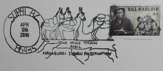
We found our way to the camp check in office, paid our fees and then wondered over to the store, bought something to drink, and mailed our post cards at the post office. The post mark I found when I returned home is shown below. A memento of the date and time a well as a great trip.
As were started out for the campground area we walked north past the school, then a small church. Then we were out of town heading toward the Camping area another 2 miles from town.
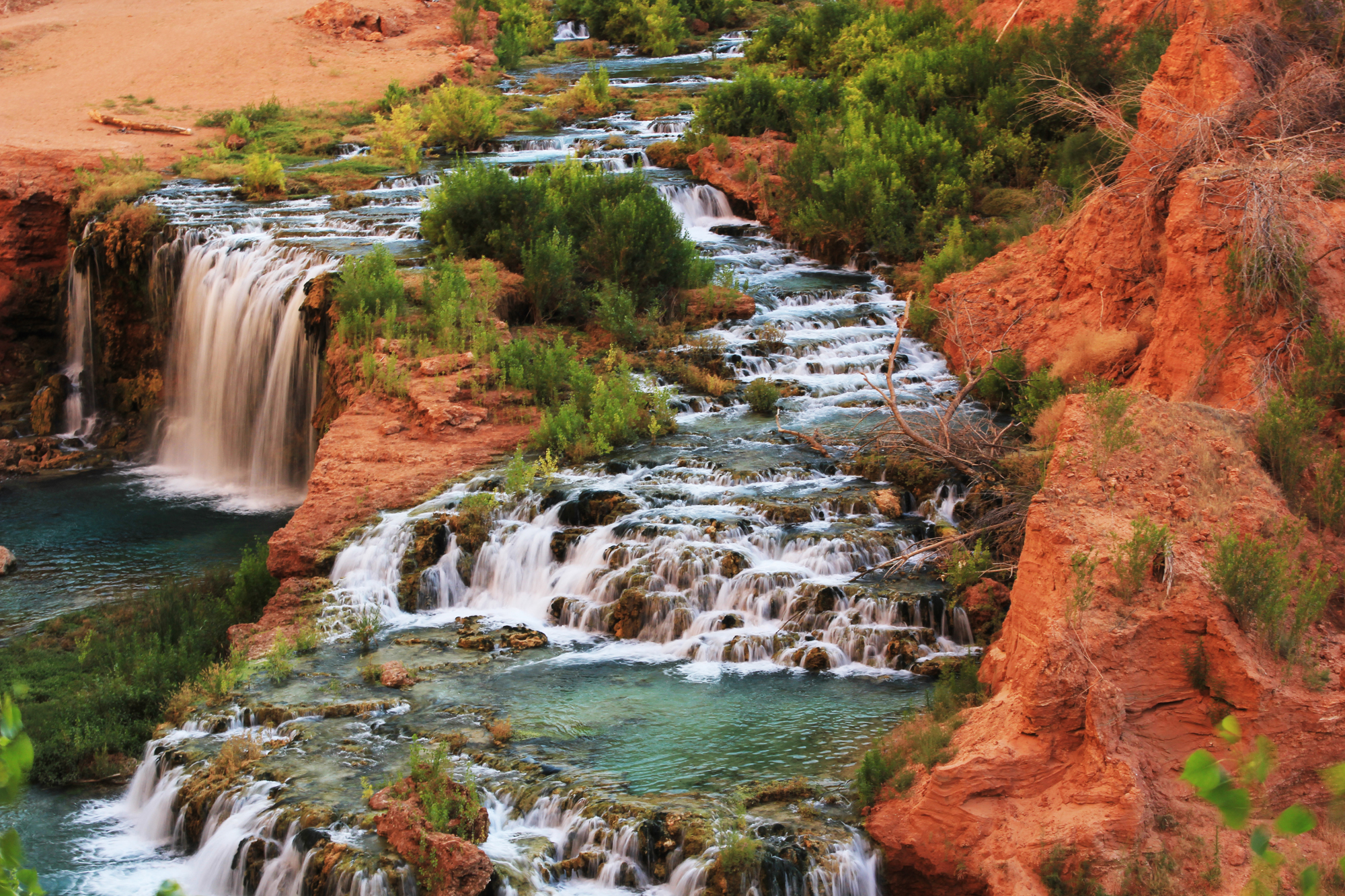
We soon came to Navajo Falls on the way to the campground. Navajo Falls at this time was totally different than what you see today. A flash flood was to later completely alter this waterfall.
The trail constantly dropping, we soon came to a second sight…Havasu Falls. This falls is located just before reaching the campgrounds
The color of the water against the sandstone was breathtaking. What you see captured by a camera will never compare to the real view! Nor the sound of the thundering water dropping over 100 feet to the pool below.
From here we proceeded to the campground area. We replenished our water at Fern Spring. Though it is supposedly safe we pumped it through a filter to insure we had no problem. The water tasted great and was really cold.
This last leg to the campground took about 45 minutes. This would make the total one way trip to be 11 miles. The 11 miles would be from the Trail head to the Campgrounds. Our GPS would later tell us we hiked more like 12 miles. Total hiking time was in the 4 hour range.
We set up camp and proceeded to hike downstream to Mooney Falls, Mooney Falls is 210 Feet high and is quite impressive too. We messed around there too until we thought we should head back to our tent and fix dinner.
We eventually made it back to camp and started to relax. The winds picked up and we could tell weather was changing and the cold front we feared was moving in. Toward dusk the winds kicked up to 50 MPH and gusted even harder.
The cottonwood trees we were under started losing some rather larger limbs. We opted to move all of our tents to a safer location. (Note to self: check what is above you before setting up camp – their can be widow makers above you).
The winds kept up until the early hours of dawn. We had sand in the tents, up our nose, and in our ears. We had slept with T-shirts pulled over our faces. The winds were ushered in with a major cold front. The temperature had dropped drastically from the 80 degrees the previous afternoon. We were up at first light, having already decided we better head out to beat the rain that was sure to come.
Our plan was to get all the way back to the base of the switchbacks and camp there for the night. Then do the last 2 miles up the switchbacks the next morning.
About half way to the village the rain hit us. The wind kicked up again. We dug out our rain gear and put it on. It was cold enough now we didn’t want to be wet on top of dealing with the cold air.
We made it to the village and looked back to the north. The sky was looking dark and nasty. Raining hard or snowing in the distance. It was certainly cold enough for it to be snow squalls.
We pushed on hard knowing this time the grade was to be all up hill. We took GPS readings at several points and realized our time was a pretty quick pace. The dark cloud seemed to be moving in just behind us. It did stop raining for awhile. We pushed hard but could not increase our speed much more. The miles clicked by slow and hard. We took only 2 short breaks along the way.
We eventually made it to the last 2 miles. The switchbacks were before us. The decision to camp or continue up the switchbacks was also facing us.
It was cold and starting to snow on us now. We voted to scrap making camp in the rocks. We all opted to continue on to the top. The switchbacks proved to be brutal, carrying heavy packs. It was painfully slow. We crested the top with it snowing hard and really cold. We were soaked inside and out. We were soaked on the outside from the rain. Boots socks and everything not covered. Soaked inside with sweat from pushing so hard. Luckily we all had a clean dry change of clothes in the vehicle.
We crested the summit with stiff calf muscles, and memories for a lifetime! We knew we would return.